Stories are a-plenty when it comes to the lives and legacies
of the men and women that chose, even for a small amount of time, to call the
New Santa Fe area home.
 |
| Painting of the Santa Fe Trail by William Becknell (c. 1790-c.1832) |
I am particularly fond of those families that didn’t blink
an eye when it came to moving into unchartered territory- areas never settled
by the whites…
The Wild West.
I suppose these men and women had nothing to lose and
everything to gain. They saddled up their horses, packed their minimum
belongings, planned their route and followed their dream.
I have thought about this from all angles, and I still am
awestruck by all these people that didn’t hesitate to bail.
Girl Scouts taught me to tie a sweet knot and even build a
fire, but my “roughing it” skills certainly wouldn’t suffice to survive back in
the 1800s.
Like, seriously. Forget it. Dead woman walking.
What would possess these people to leave everything behind? It
couldn’t have been that bad in in the eastern United States, right?! Why leave?
Why risk everything?
Simple.
Can you imagine today if houses in small towns were given
away for free or for a small pittance of what they were truly worth? If you were
struggling would you take the risk? Would that be enough for you to uproot your
family?
 |
| The Louisiana Purchase of 1803 is said to have opened up the West |
In the mid 1850s, a myriad amount of men were motivated by
miles and miles of acreage. By 1860, the United States held 1.6 billion acres
of land- mostly available for purchase. Treaties, such as the Louisiana
Purchase, had added land faster than the government could get rid of it.
This may seem boring, but this information is essential to
understanding how the government surveyed land and created the grids we have to
this day.
And to be clear, acreage was currency. It was the moolah,
the big showboat, the gift of the new frontier. No one was willing to risk it
all without the distinct probability that land was up for the taking.
According to the Land Ordinance of 1785, all territory west
of the Appalachian Mountains was to be settled in an “orderly” way. How do you
make it orderly? Well, the government hired surveyors to comb the land and
divide it as territory was acquired. The land was divided into townships that
are mainly six miles square with 36 sections per township. Land had to be
surveyed before it could be sold. Have you ever thought about how our current
streets were platted? They usually run through the split between one section
and another- both north and south, west and east.
 |
| This image shows the way in which the Land Ordinance of 1785 was surveyed and divided into townships within counties. |
As mentioned in a previous post, Washington Township, where New Santa Fe, Martin City, Grandview and Hickman’s Mills are currently located, was known as one of the “Lost Townships.” The story in the history books state that the surveyor of the land may have had a wee bit too much interaction with the Native Americans near the Blue River, and this resulted in a bit of drunkenness. Thus, the surveyor lost his notes. In order to cover his tracks, he reported to the government that the land was not inhabitable, so it didn't need to be surveyed.
Not inhabitable = no legal settlement of the land.
You couldn't purchased land that wasn't surveyed.
You couldn't purchased land that wasn't surveyed.
This would have scared off most of white settlement for a
bit… and it did.
Regardless of whether you believe the story or not, the
result was fatal to the early records for settlement of the area. Accounts are
scarce and settlement was slow. Chronicles of the squatters that most likely
first turned the soil are limited.
I’m asking you to use your imagination.
When I research the area, I check things from all angles.
When a new name comes up, I search their history and their family to see what
happened in their own personal story. Therefore, land becomes more than just
land- or an old house becomes more than an old house – or a piece of broken
pottery found while gardening becomes more than trash.
It becomes a story.
My own imagination soars when I find new names and then
spend time scouring the archives or reading the unique treasury of land grants. The pieces of
the puzzle transform into so much more.
Because land is divided into convenient sections, I can look
on a map and navigate land deals throughout history. For the record, New Santa
Fe falls in the southernmost part of Section 7. Just to the south of Section 7 (this section has borders just to the south of current Santa Fe Trail and follows State Line to
the west and Wornall to the east) is Section 18.
 |
| The earliest atlas of Washington Township, Jackson County, Missouri from 1877. No earlier plat exists due to the Lost Townships being undocumented. New Santa Fe can be located in Section 7. |
Reading these land records is like trying to read the Bible
in Latin. You get the concept but the language is complete gibberish. Today, we
have addresses and land plots and subdivision names.
If you were identifying land with few trees, sporadic
fences, a creek and no houses, how would you describe it?
Land records become comical. When describing the precious
land someone has laid out good money for, they refer to rocks, stones, lone oak
trees and other landmarks that we cannot even begin to find today- because they
don’t exist anymore. So, once again, we have to use the powers of assumption.
I’ve always been especially curious about Section 18 because
of what it currently contains. Today, it comprises Timber Trace subdivision, Blue Hills Country Club, Blue Hills subdivision, and an old, historic home that served as a
tavern on the Trail.
Old land maps dotted with farms, groves, cemeteries and
schools confirm what was where before Google Maps and Google Earth were
available.
Some of those reading this post live on the land I’m
describing. And that’s really cool. Currently, hundreds and hundreds of homes
dot the landscape of what was once the sole property of one man.
My quest led me to an interesting story of the first land
record for Section 18 – a story intriguing enough to devote a blog entry to it.
 |
| Location of Fort Wayne, Indiana |
Anthony Davis, born in Washington County, Kentucky in 1794,
was a man with multiple interests and ambitions. The biggest of his ambitions
in the Midwest- still the WILD West- was
serving as an Indian agent in in both Indiana and Kansas.
Unlike most pioneer settlers, Anthony Davis decided to move for a pretty important job. He didn’t uproot his family in hopes of finding the land of milk and
honey- he already had a lot of the hard part completed.
You see, he was employed. Most of these guys that left the east
were farmers. This was their sole employment. He, like
most everyone else in the west, wanted to farm- but that wasn’t his main gig.
Let’s back up a second to Anthony’s endeavors pre-Jackson
County, Missouri.
As a young man, Anthony moved to Indiana with his family. By
1834, he was married to wife Jane and had three children. He moved to the area
that is now known as Fort Wayne, Indiana where he helped build the community.
According to the Indiana Magazine of History, Mr. Davis was
the first clerk of the court, held offices in Harrison and Allen County (Fort
Wayne) and served as a state representative in 1829 and 1830. Davis Street in
Fort Wayne is named after him. He began his career as a merchant in Fort Wayne
and began to sell supplies to the Indian agency.
 |
| Painting of the Kee-Waw-Nay Potawatomi Village in Indiana |
In 1834, Davis was appointed as an Indian agent to reside with and
to take care of a group of “emigrating” Potawatomi, or we locals seem to spell
it- Pottawatomie. When the Potawatomi of the 1838 emigration settled in the
Osage River country, Davis was appointed as sub-agent.
I’m sure you’re familiar with the government’s early efforts
to “emigrate” Native Americans. Let’s call it what it was- pushing Native
Americans off their lands and forcing them to move to areas that at the time
weren’t settled by whites.
Anthony was front and center in the massive resettlement of
the Potawatomi’s to the areas near the current Kansas City metropolitan area.
In a way, this guy was in charge. Well, he was at least in charge of the new reservation near the Maris des Cygnes River in present-day Miami County, Ks.
With the looming relocation of the Potawatomi tribe from
Indiana to Kansas Territory, Anthony moved his family. The first record in
Kansas Territory that I am able to find for him shows him living in 1835 in
Kickapoo town near Lawrence.
But, he was also involved in the “Platte Purchase” in
Missouri, which the Native Americans were paid $7,500 for 3,100 square miles of
land. To put this in perspective, it included what now makes up six full
counties in Missouri: Platte, Atchison, Buchanon, Holt, Andrew and Nodaway.
 |
| Map showing the location of the counties included in the Platte Purchase of 1836 |
Yeah, 3,100 square miles to 29.
Remember, Anthony Davis came from Indiana. And, the
Potawatomi had ceded their native lands in Michigan and Wisconsin in a treaty
in 1829. They were placed on reservations in Indiana.
But, as the history books tell us, the peaceful removal of
the Native Americans didn’t end there.
In return for land cessions, the US promised new lands,
annuities and supplies to enable the peoples to develop new homes. By 1833, a
new treaty was enacted due to more European settlement in the area.
The land had become valuable- and the government wanted to promote settlement. So, it was time for the Potawatomi to be moved yet again. The Illinois Potawatomi were removed to Nebraska and the Indiana Potawatomi to Kansas, both west of the Mississippi River.
 |
| A map showing the location of the Potawatomi reservation in current Miami County, Kansas. Image courtesy of Dolores J. Rush |
In 1837, the Kansas reservation near the Osage River, just
west of Missouri in current Miami County, Kansas was surveyed for the Indiana Potawatomi’s. It was about 36 to 42 miles in size Some, but not all, of the
Potawatomi at this time had peacefully removed to Kansas Territory.
One Potawatomi village near Twin Lakes in Indiana refused to
follow the directions of the treaty. Needless to state, this didn’t bode well.
859 names were recorded of these Potawatomi that stood
strong in Indiana. Along with militia, these men, women and children were involuntary
pushed off the land in 1838. A 650-mile journey from Twin Lakes to Osawatomie,
Kansas began.
 |
| The Potawatomi Trail of Death |
One hundred armed soldiers made sure the tribe got to their
final destination. Sixty-one days of hell, walking under dusty, dry and
trechorous conditions…
Out of the 859 names recorded prior to departure from
Indiana, 42 Potawatomi perished on the journey, 28 of them children. This
removal came to be known as the “Potawatomi Trail of Death,” a name credited to
Historian Jacob Platt Dunn in his book, True
Indian Stories (1909).
And who was awaiting to greet them? Anthony, of course.
As subagent, he was one of the men in charge of resettling these brave
Potawatomi in the area. He continued his work with them, trading things such as
blankets and rifles to them.
The sad saga of the Potawatomi unfortunately didn't end in Miami County, Ks. Soon after the Trail of Death Potawatomi entered Kansas Territory, other bands of the Potawatomi from the Council Bluffs area and from Iowa were "relocated" into the area and were settled north of Osawatomie.
Many of those Potawatomi that were on the Trail of Death were resettled at Uniontown west of Topeka. As white settlement moved further west, they, and other Native American tribes that were relocated to Kansas, were pushed yet again off the land and forced into Oklahoma. Others decided to stay on private lands and not on the reservations.
There were various bands of Potawatomis, and each of these groups had different challenges as it pertains to the relocation efforts men such as Anthony Davis managed over. These different groups have very different stories. For example, two tribes were formed in 1867 after the revision of a treaty - the Citizen Band of the Potawatomi's opted to sell their lands in Kansas and move to Shawnee, Oklahoma while the Prairie Band of Potawatomi's held onto land in Jackson County, Ks. They still have a reservation there to this day.
The sad saga of the Potawatomi unfortunately didn't end in Miami County, Ks. Soon after the Trail of Death Potawatomi entered Kansas Territory, other bands of the Potawatomi from the Council Bluffs area and from Iowa were "relocated" into the area and were settled north of Osawatomie.
Many of those Potawatomi that were on the Trail of Death were resettled at Uniontown west of Topeka. As white settlement moved further west, they, and other Native American tribes that were relocated to Kansas, were pushed yet again off the land and forced into Oklahoma. Others decided to stay on private lands and not on the reservations.
There were various bands of Potawatomis, and each of these groups had different challenges as it pertains to the relocation efforts men such as Anthony Davis managed over. These different groups have very different stories. For example, two tribes were formed in 1867 after the revision of a treaty - the Citizen Band of the Potawatomi's opted to sell their lands in Kansas and move to Shawnee, Oklahoma while the Prairie Band of Potawatomi's held onto land in Jackson County, Ks. They still have a reservation there to this day.
 |
| Abstracts of articles relating to the Potawatomi in Miami County with Anthony L. Davis serving as Indian subagent, 1839-1840 |
After several years working with the Potawatomi, it appears Anthony was ready to settle down and get some land. Familiar with the area of Kansas Territory, which was not open to white settlement (yet), Davis jumped over to the Missouri side and purchased land in Jackson County, Missouri.
In 1846, he was able to purchase the north half of Section
18, containing 154 acres. In 1848, he purchased the south half of Section 18,
containing 144 acres. This is the land that currently is bordered by State Line
to the west, Wornall to the east, approximately 122nd Terrace to the
north and Blue Ridge Boulevard to the south.
That’s quite the farm.
In any case, identifying what was on the land in Anthony’s day is hard to decipher, because land
records don’t talk in terms of housing. But, a lot can be told by the amount of
money paid when the land was sold.
Anthony sold his land at a pretty big profit.
Why do I care about this? Because this includes the land
that holds what was an inn or tavern on the Santa Fe Trail. When was it built?
Who built it?
Some records state the original structure was constructed in
the 1840s… about the time when the very first land record surfaces for this
stretch. Anthony’s land record.
Did HE build it? Quite possibly.
But, as many pioneers of the era did, Anthony Davis didn’t
stay too long. The west was calling him. In April of 1850, Mr. Davis and his
wife, Jane sold their tracts of land to a man named William S. Gregory.
Does the name ring a bell?
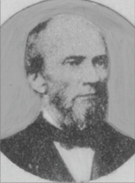 |
| William S. Gregory (1825-1877), first mayor of Kansas City Missouri Valley Special Collections |
The first mayor of Kansas City, William S. Gregory bought Anthony
Davis’ land for a total of $3,200. This may not seem like much, but it was for
back then- and that tells me there was more than just land being sold. This was all before the official incorporation of
New Santa Fe.
More on William S. Gregory’s time in New Santa Fe later!
Anthony Davis left for the west shortly after selling his
property and, at the ripe old age of 56, ventured with his family to the Oregon
Territory, settling in what is now known as Portland.
This guy sure knew how to pick his locations!
In December 1850, he’s already settled in and is running a
boarding house in the Pacific Northwest.
He didn’t stop his ambitions even after moving. He helped
organize the first public school in Portland, Oregon in 1852 and was elected
Justice of the Peace in 1854. He then was appointed Circuit
Judge in 1858.
Don’t be surprised that the historic district in Portland
includes Davis Street- named after good ol’ Anthony Davis. That makes for two
streets in two cities!
 |
| Major Anthony Litsey Davis' final resting place. Lone Fir Pioneer Cemetery, Portland |
Anthony L. Davis settled just off the
Santa Fe Trail yet remained unsettled for most of his life. Starting in
Kentucky, pushing north to Indiana and then pushing out Native Americans to
Kansas Territory, Anthony encompasses a true pioneer spirit. His contribution
to pivitoal areas of the country, including Washington Township in Jackson
County, should be acknowledged and, in some ways, admired.
We don’t have agree with everything these pioneers did, but
we should embrace the history of this country. Anthony Davis helped bring white
settlement to the West. These pioneers of Jackson County are fascinating and
free-spirited. The swing of their hammers and the plunge of their shovels built
the foundations of the community.


